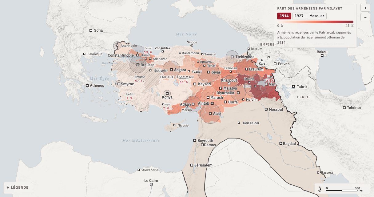
From the round-up of 24 April 1915 to the Treaty of Lausanne, the map follows in fifteen steps the destruction of the Armenians of the Ottoman Empire and the dispersal of the survivors. When it opens, an animation traces the three main deportation routes, the massacres and the camps of the Euphrates line as far as Deir ez-Zor, then the years 1918-1923: the Republic of Armenia, the return of survivors to French-occupied Cilicia, Wilsonian Armenia, the Kemalist offensive of 1920 and the final exodus.
The map can then be explored freely: each massacre site opens on its death toll and the convoys that led there; each city compares its pre-war Armenian population with that of the 1920s; the shading of the vilayets shows the share of Armenians in 1914, then in 1927. The legend lets you hide each type of element, or all of them at once.
The figures come mainly from the work of Raymond Kévorkian and the censuses of the period; each step and place gives its source. The lines of the Russo-Ottoman front are approximate; the vilayets and the French zone are reconstructed from present-day provinces. The interactive map itself is in French.